Holywell Lane
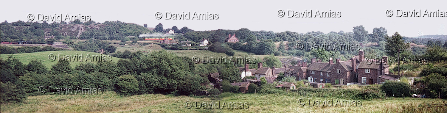
Photo courtesy of © David Amias.
A view over Holywell Lane, Lightmoor with Gravel Leasowes in the distance and Ivy Farm on the skyline at Little Dawley.
A Much Wenlock to Wellington train passes along towards Doseley Halt and on its way to Wellington.
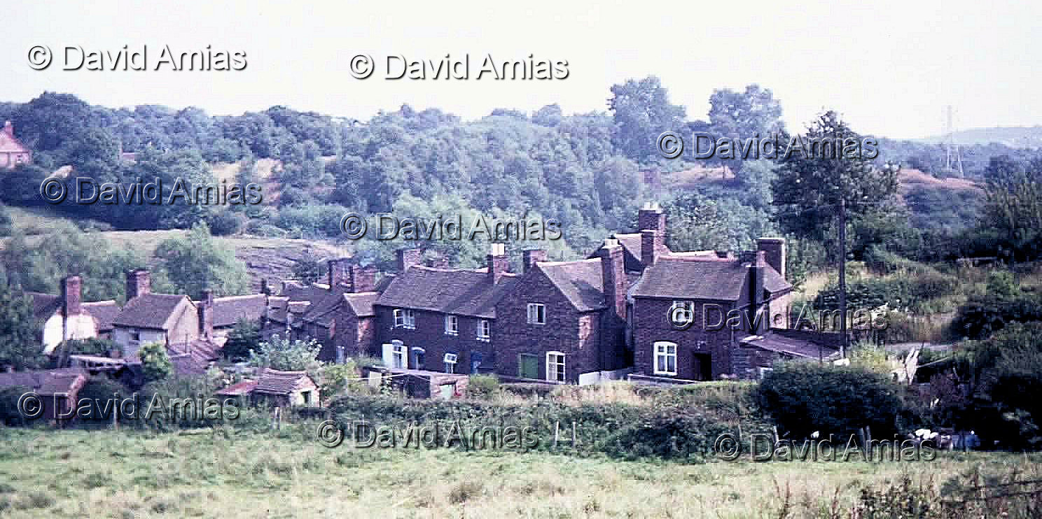
Photo c. 1970 courtesy of © David Amias.
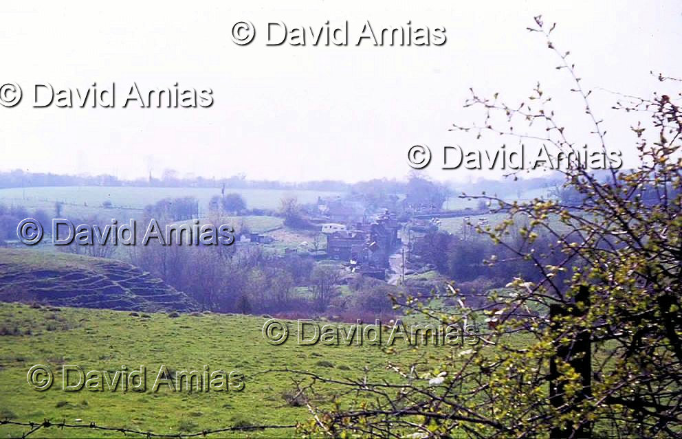
Photo courtesy of © David Amias.
Holywell Lane c1970 viewed from Gravel Leasowe.
Boatwell meadow in foreground with Wycherley field on distance left hand side.
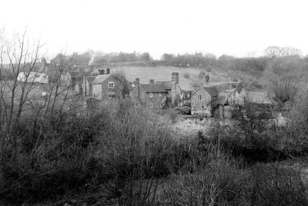
Photo courtesy of Dawley History Group.
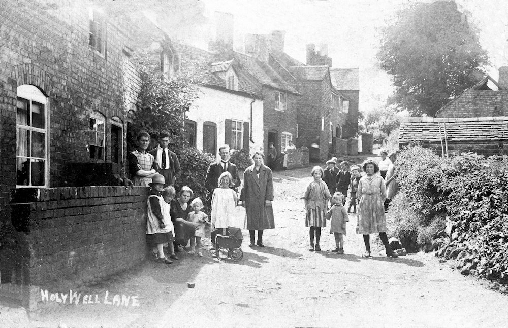
Photo courtesy of Dawley History Group.
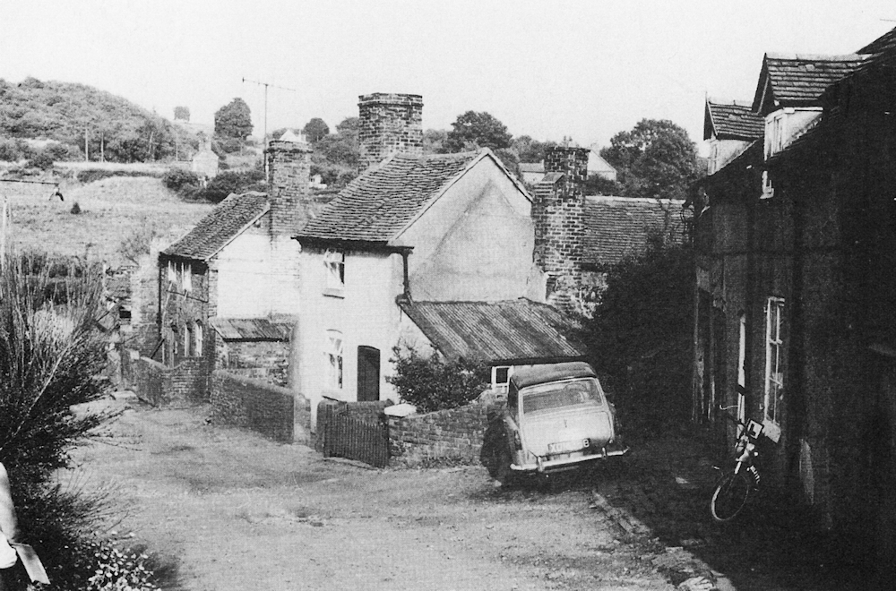
Photo courtesy of Dawley History Group.
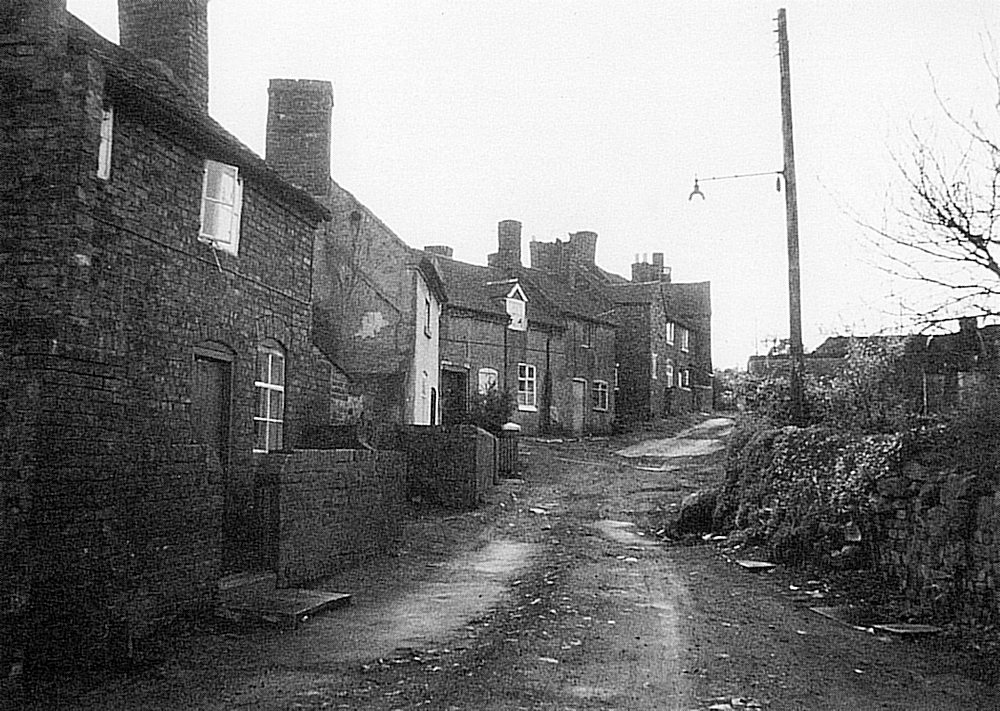
Photo courtesy of Dawley History Group.
Holywell Lane, a rambling route which led westwards from Little Dawley towards Little Wenlock, was a small settlement but one whose history reveals much about such communities. In 1772 it consisted of six cottages, probably of squatter origin, built in slangs alongside the thoroughfare, apparently taken from the roadside verges. By 1825 there were 26 cottages in the lane and six more had been added by 1882, untidily crammed together on land that had formerly been garden plots. Many interlocked, with bedrooms of some cottages extending over the ground-floor rooms of other. Some walls consisted of single thicknesses of bricks, and many roof timbers were unsawn. One of those standing in 1772 consisted of a ground-floor room about 12ft. x 11ft., with just a cramped sleeping chamber above. Some sleeping spaces were accessible only by ladders through trapdoors. Few of the cottages had as many as four rooms. Holywell Lane grew up on the slackly-managed estate of the absentee Earls of Craven. The virtual freeholds which some cottages acquired led to a degree of stability in the population which contrasts with the rapid rate of change in most company-owned houses. Several families mentioned in the 1841 census, and some mentioned in 18th-century records, only moved away from Holywell Lane when the cottages were cleared in the mid- 1970s.
Holywell Lane was the largest of several clusters of cottages in the western part of Little Dawley, where in the mid-18th century a pattern of small enclosed fields, medieval asserting, merged with the woodlands on hills above Coalbrookdale. By the 1860s almost all the township was covered with pit mounts, canals, railway, brickworks and the ironworking complex at Lightmoor. Settlements like Gravel Leasows, Burroughs Bank, Stoney Hill and the Finney provided accommodation for those who worked within the township and at the nearby ironworks at Coalbrookdale and Horsehay. A small cottage from the area has been re-erected at the Blists Hill Museum. It is a single-storey building, erected on pit waste about 1830, and measures approximately 20ft. x 12ft., and has two main rooms which originally had earth floors. The walls consist of coal measure sandstones, and the roof was formed of unsawn ash and birch timbers, with the bark adhering in many places. A collier, his wife and five children lived in the cottage in 1851, and 10 years later the same couple were still in residence with seven children aged between five and twenty-four. Members of the family remained in the cottage till the 1930s.
Professor David Hey has commented that ‘the origins of the Industrial Revolution are to be sought not in those areas where the peasant structure of society was destroyed, but precisely in those regions which long retained the characteristics of the peasant way of life’. This was certainly true in the Coalbrookdale Coalfield, where the open settlements along the slops of the Seven Gorge in the min-18th century. It was also true in the century that followed, when open settlements continued to grow, and housed new generations of industrial workers.
By Barrie Trinder.